Determining Offshore Use of Diving Birds Using Satellite Tracking: Surf Scoters
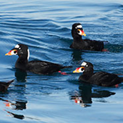
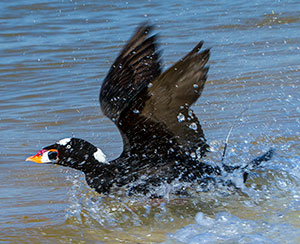
Increasing interest in offshore wind development in order to meet rising energy demands necessitates research on potentially affected natural resources that will provide regulators, developers, and the public with data that informs permitting and siting processes. Proposed wind energy areas in the mid-Atlantic region overlap with core wintering ranges of multiple marine bird species, including the Surf Scoter (Melanitta perspicillata).
Project Goals

In order to assess the effects of disturbance and the potential population impacts of offshore wind development on Surf Scoters, basic information must be collected on their distribution and behavior, including flight pathways and timing of habitat use, within proposed wind energy areas. BRI is working with multiple collaborators to meet those objectives by determining fine-scale occurrence and local movement patterns of Surf Scoters in federal waters of the mid-Atlantic U.S. during migration and winter, using platform terminal transmitter satellite tracking tags (PTTs).
Project Components

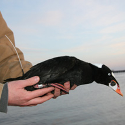
Surf Scoters have been targeted for capture on their significant wintering areas in the mid-Atlantic, as well as a major fall staging area in the Gulf of St. Lawrence estuary. Mid-Atlantic wintering areas have included Delaware Bay, Chesapeake Bay, and Pamlico Sound. Individual birds are captured using varying techniques. One method is night-lighting at sea with large handheld dip nets. Another efficient and safe capture technique is a floating mist net array, with the use of decoys. Wildlife veterinarians conducted overall health assessments of birds, and each bird was implanted with a satellite transmitter and released at its capture location.
Satellite transmitters send individuals’ location data to orbiting satellites during set periods of the day, which can then be mapped. Tracking individuals will be used to identify high use areas during winter and migratory periods, including important offshore migration corridors. Additional opportunistic research topics being examined during this study include general health assessment findings and contaminant exposure risk.
Project Updates

Capture efforts conducted in 2012, 2013, and 2014 resulted in the deployment of 60 satellite-tagged Surf Scoters. Tracking results to date have yielded critical and previously unknown information regarding the species’ winter habitat use, migration routes, and breeding locations. Surf Scoters wintering in the mid-Atlantic region primarily migrate along the Atlantic coast northward to Canada. The Surf Scoter breeding areas consist of interior forested lakes in Quebec and Labrador.
Additional funding provided by the Bureau of Ocean Energy Management for a fourth field season beginning winter 2015 will extend what was initially a 3-year study, which will serve to strengthen the study by increasing the overall sample size and test alternate tagging techniques designed to increase tag life and reduce invasiveness over implanted PTTs.
Project Funding & Collaborators
This satellite tracking study builds upon work initiated by the Sea Duck Joint Venture. Additional funding was provided by the Department of Energy and the Bureau of Ocean Energy Management.
Research partners include the Sea Duck Joint Venture, the U.S. Fish and Wildlife Service, U.S. Geological Survey Patuxent Wildlife Research Center, and Environment Canada.


